Singapore MRT Map 2025
Whether you’re a daily commuter or first-time visitor, this site is your go-to destination for navigating the Singapore MRT system with ease. Access a real-time interactive MRT map, download high resolution mrt map & color-coded line maps, and plan your journey from point A to B — all in one place.
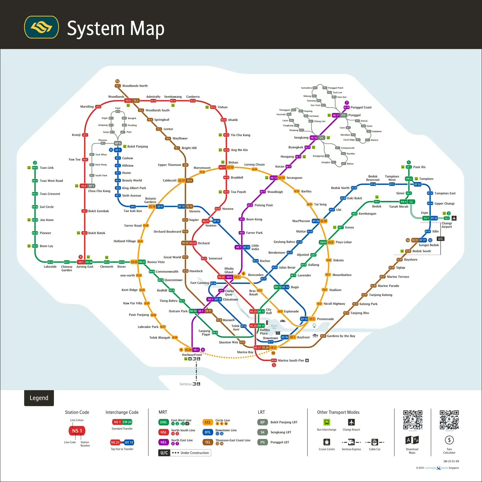
Explore the Singapore MRT Map Network
The Singapore MRT (Mass Rapid Transit) is a highly efficient, world-class rail system connecting every corner of the city. Our platform provides updated MRT maps, station details, and route planning tools for:

East-West Line
1
2
3
Code: EW
Color: Green
Circle Line
8
9
10
Code: CC/CE
Color: Orange
North-South Line
4
5
Code: NS
Color: Red
Downtown Line
11
12
Code: DT
Color: Blue
North East Line
6
7
Code: NE
Color: Purple
Thomson-East Coast Line
13
14
Code: TE
Color: Brown
Popular MRT Stations
Download the MRT Map PDFs (Different Languages)


Download All Lines Maps PDFs


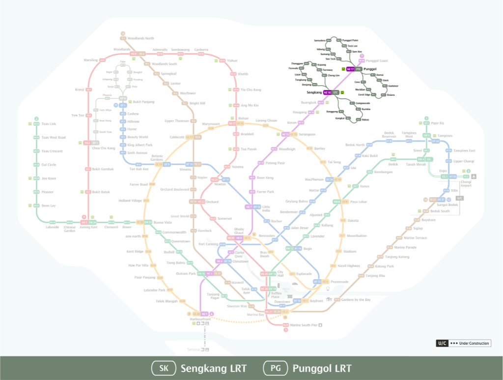
Download LRT Maps PDFs

Download Old Lines Maps PDFs
You can also download Singapore MRT Map 2024

The MRT Map Today — and Tomorrow
Currently, the MRT system stretches over 200 kilometers, comprising 6 major lines and over 130 stations — with full integration into LRT lines, bus interchanges, and airport transfers. But that’s just the beginning. By 2040, the network is projected to expand to 400 kilometers, nearly doubling its capacity and adding three new lines to improve connectivity in underserved regions.
Operating Hours and Train Frequency
Singapore’s MRT system runs daily from 5:30am to midnight, with high-frequency intervals during peak hours (7–9am and 5–7pm). Trains arrive every 2–3 minutes during rush hour and every 5–7 minutes off-peak.
Note: On the Thomson-East Coast Line, some segments such as Woodlands North to Woodlands South close early at 9:00pm and open slightly later on weekends.
Operating Hours and Train Frequency
The system is operated by two major public transport companies:
Despite different operators, the fare system, ticketing, and train frequency remain consistent across the network.
Smart Ticketing & Travel Apps
There are multiple easy ways to travel using Singapore’s MRT:
Payment Methods:
Travel Apps:
These apps are available on both Android and iOS for seamless travel planning.
New Features You’ll Love
There are multiple easy ways to travel using Singapore’s MRT:
Attractions Near MRT Stations
Elevators at all stations
Family & Tourist Friendly
These apps are available on both Android and iOS for seamless travel planning.
Station Design, Codes, and Interchange Tips
Each station is labeled with a unique code + name (e.g., DT20 Fort Canning), and stations with multiple connections are labeled as interchanges — allowing you to transfer easily between lines.
Fun Fact: Stations like Dakota (CC8) were named after historical aviation references (Dakota DC-3 planes), while many underground stations double as civil defense shelters, built to withstand bomb blasts.
Planning Your Trip with Ease
Whether you’re commuting to work or exploring the city, tools like Google Maps, CityMapper, and LTA’s MRT Journey Planner help you:
MRT Etiquette Tips for Visitors
Whether you’re commuting to work or exploring the city, tools like Google Maps, CityMapper, and LTA’s MRT Journey Planner help you:
What’s Next for Singapore MRT?
By 2040, Singapore’s MRT system aims to: